In 1976 I was told about a "mine" in Haskell/Pompton Lakes, New Jersey which had supposedly been blown up by German saboteurs during World War I. A friend of mine (Frank) offered to show me around the area, as he lived near the Haskell end of the area. In the fall of 1976, I visited it for the first time.
My Dad had given me an old Korean-war-era Canon 35mm camera. It had a rather sticky shutter which also had some pinholes, and of course it was manual focus, manual exposure, etc. I loaded it with the only film I had (Agfa ASA64 color slide film - in retrospect, not a particularly good choice for this application 8-). We also packed a Radio Shack 6-D-cell flashlight (at the time, Radio Shack would give them away for free).
Entering the woods near the candle factory in the industrial part of town, we used a hunting trail and access road (a gas company had run an interstate pipeline through the area some years previously). It was immediately obvious that this was part of a huge, long-abandoned industrial complex - ruins of brick and concrete buildings were poking out of the ground all over the area. Some concrete walls were several feet thick, and showed marks of serious explosive damage - well beyond what could be inflicted by hunters shooting guns.
As we moved further into the woods, the trail became narrower and narrower. At some points we needed to climb on old walls as the ground was deeply cratered.
Eventually we came upon a much newer chain link fence. It was still old and somewhat rusted, but obviously dated from a much more recent time than the ruins we'd seen. Part of the bottom edge of the fence had been peeled up at the corner, so we went in. After climbing about 1/4 of the way up the side of the mountain, we found the remnants of an asphalt-paved road that sort of ended in mid-air.
Upon following the road, we rounded a corner and found the strangest sight - 2 railroad gravel hopper cars, completely rusted out, with a metal shield between them, apparently coming out of the side of the mountain. These were not narrow-gauge rail cars, but full-size cars. Bear in mind that this was maybe a third of the way up the side of the mountain.
Proceeding around the left edge of the railroad cars, we found that a small piece of the iron edge had been blown away, apparently by some high explosive. Later on, I discovered that another friend of mine (Rich) claimed to have done this a year or two earlier, but he says he never went inside. I took a picture of the flashlight (for scale) next to the opening that had been blasted through the entrance. If you look at this picture, you can see a wet plywood board under the flashlight, so apparently some people were getting inside. Based on the modern debris inside, which was only near the entrance, I don't think many people went far inside, though.
About 50 feet to the left of this entrance, we found a small opening somewhat higher up the mountain face, but it only went back a few feet. Apparently it was an earlier attempt that had been abandoned for some reason.
We then entered the tunnel through the opening, and it was a tight fit. I took a number of pictures inside, which didn't come out too well (remember, this is ASA64 film, in the dark). But they are probably the only pictures ever taken in there. I'll describe the pictures in detail later on.
There were a number of smaller side tunnels in the shaft, as well as a concrete ridge in the back, with a large body of water behind it. On a later trip, I brought a line and weight and tried to determine the depth of the water, but I ran out of line at 100 feet. This water was very salty-tasting.
I visited the area again over the next few years, and found some very odd things going on. Here are some examples:
- After a heavy rain, part of the trail washed out, exposing some electrical wires with very heavy insulation which had been buried more than 8 feet deep in the ground. The wires were obviously live, as there was a perceptible hum. On a subsequent visit, we found that new concrete had been poured over the entire area where the wires had been exposed.
- The mountain was crisscrossed by very old-looking flexible conduits laying on the ground. Sometimes the conduit would go into a hole drilled in the solid rock of the mountain. Out of curiousity, I opened up one of the junction boxes and was quite surprised to find what looked like a brand-new coax cable with plastic insulation inside.
Around 1985, I wanted to show this site to another friend of mine. After hiking all the way back there with my friend, his wife and daughter, we went through the same hole in the fence, only to find that the hopper cars and all other outside materials were removed, and some really poor-quality metal plates had been welded over the opening. These plates were at least 3/4" thick, but had a really rough surface and had already begun rusting badly.
Each image is clickable to present a full-sized version. Additionally, the original .TIF scans are available here. Note that these are quite large files (for printing on 8.5x11 paper on a 600 DPI laser printer). These are un-cropped, un-corrected scans and will require cropping and retouching to be usable. Please read the Legal Notice before downloading any of the .TIF files.
To do:
- Re-visit the site with a better camera. While it won't be possible to enter restricted areas (I'm a law-abiding citizen now), I may be able to collect additional information.
- Research dates and names (was this really the Pompton Powder Works?)
- Update this web page based on feedback from viewers.
March 31, 2003 update: I did take many additional pictures of the site, on the west side of the river (where the pictures currently on this page were taken). I have to go back and photograph the east side of the river, which is apparently no longer part of DuPont. Further, I have information that DuPont purchased this site from the original owners, Laflin Rand. I have obtained a number of old histories of DuPont which I will be reading for any additional information on the site. I will be sending a one-time-only email message to everyone who has contacted me about this web page once I update it (don't expect it until late summer 2003 at the earliest).
![[MapQuest map]](mapquest-s.gif)
A map of the area, courtesy of MapQuest. Note that Lake Inez (the lake under the "Wanaque River" legend) no longer exists, as the dam failed some years ago.
![[Wide aerial view]](aerial-wide-s.jpg)
A wide aerial view of the area, courtesy of Microsoft terraserver.
![[Closeup aerial view]](aerial-closeup-s.jpg)
A closer view of the area, also from terraserver.
![[Old stone wall]](powder04-s.jpg)
As I said, the shutter on the camera was sticky. The pictures get better as we move along, though.
This view is near the north end of the area, and shows an old stone wall. This area was called Flint Hill by the local residents, as many objects they called flints could be found here. These objects are cylindrical, approximately 1/8" in diameter by 1/2" long, though some are curved from being buried in the soil for long periods. When dried out, they burn with a strong but sputtering flame for several seconds after being lit, and are almost completely ashless when burned. I do not know if these are residue from the Powder Works or pre-date it. Judging by the style of constuction (stone, not brick) in the area, this is one of the oldest parts of the site.
![[Another view]](powder05-s.jpg)
Another view of the same area.
![[Marks on wall]](powder06-s.jpg)
The "inner sanctum" of the building shown in the next picture. You can see marks on the concrete where a metal chest or cabinet of some sort was attached to the walls.
![[Z-shaped building]](powder07-s.jpg)
An oddly constructed building, in a "Z" shape. The previous picture is from the center of this building. Note the thickness of the concrete walls. Local history says that this building is where explosive fuses were assembled.
![[Brick building]](powder08-s.jpg)
The remains of a brick building, looking out over Lake Inez. The ground slopes steeply down toward the lake here, so that the ground where I was standing is actually several floors high when you look at the building from the river side. There are concrete piers in the building which seem to have supported wood floors. This building is of normal brick construction and may have been some sort of office. Off to the right were ruins of rails and what looked like a winch, which may have been used to pull things across the lake from the other side.
![[Unusual foundation]](powder09-s.jpg)
There were a number of these strange foundations scattered around the site. They are about 6 feet from front to back, 12 feet wide, and vary from 10 to 15 feet deep (but that's just to the leaves on the bottom - the actual bottom could be much deeper). They were always on the sides of hills, with the foundation lip about a foot from the highest ground.
![[Plug side view]](powder10-s.jpg)
Here we get to the heart of the matter - this is a side view of the hopper cars and the metal plug. Note the thickness of the curved metal part between the hopper cars - it is over a foot thick. The wood covering it where the plug meets the wall is angled to form a wedge.
Normally, the hopper cars and plug would be pushed further toward the mountain, ramming the wood part into the tunnel. The hopper cars are full of gravel.
![[Plug end view]](powder11-s.jpg)
A straight-on view of the 2 hopper cars and plug. This is truly massive.
![[Flashlight and hole]](powder12-s.jpg)
The Radio Shack flashlight next to the hole that Rich made in the metal. This was more a case of bending the metal than actually removing any, as you can see from the bends on the left side. I'm told this was done with a piece of explosive the size of a plain M & M candy (more on this later).
![[Looking southeast]](powder13-s.jpg)
A view from the top of the mountain (above the tunnel) looking southeast. The lake in the distance is Pompton Lake. Also note the "power line to nowhere" about 3/4 of the way to the right and 1/3 of the way from the bottom. This served the DuPont facility on the other side of Lake Inez. More on this below.
![[Looking south]](powder14-s.jpg)
Looking more to the south, we see the end of Lake Inez on the right.
![[Lake Inez and shed]](powder15-s.jpg)
Looking down on Lake Inez from above the tunnel. On the lake, you can see the ruins of a pipe bridge, as well as a very modern-looking shed, pier, and power lines. Given that this side of the river was allegedly abandoned, I'd say something fishy was going on. We did not go down to investigate as that area was in clear view of the active operations on the other side of the river.
![[Metal anchor #1]](powder16-s.jpg)
Inside the tunnel. This is some sort of large metal anchor.
![[Metal anchor #2]](powder17-s.jpg)
Another view of the same anchor.
![[Cylindrical object]](powder18-s.jpg)
This was an odd item. It was very deformed from an explosion, but from what I could tell, it was originally roughly cylindrical and perhaps 2 feet in diameter and 6 feet long. It was mostly buried in the "sand" in the tunnel, which later turned out to be still-functional explosive.
As I recall, it was quite difficult to hold the flashlight, take light and focus readings, and then take the picture while shivering in the cold.
![[Cylindrical object]](powder19-s.jpg)
Another view of the same object. The metal was about 1/4" thick and was grayish in color. When tapped, it seemed like a light metal like aluminum or magnesium.
The steel objects
I don't think either of those existed in large quantities during the WWI timeframe, but I did find two metal disks which I took with me and had analyzed later on. Those disks were an unusual type of stainless steel, and when scrapings were put in an oven to burn off contaminants, the oven exploded - apparantly part of the material encrusting them was explosive.
Click here for another page with pictures and descriptions of these objects.
![[Dam at end of tunnel]](powder20-s.jpg)
This is a view over the concrete dam which is holding the water back at the far end of the tunnel. The tunnel continues beyond this point and slopes down into the water. The water is apparently quite deep (I tried to measure the depth and ran out at 100' of rope). I have been told that this served the same purpose as the trap under a sink - to prevent gases from escaping, and that this tunnel dips down in a "U" and comes back up. The idea was apparently to set up high explosives and measuring instruments at the far back of the tunnel (after it comes back up out of the water) and then fill the trap with water and roll the plug into the tunnel to do the test.
![[Dam at end of tunnel]](powder21-s.jpg)
Another view, with more light and less focus 8-(.
![[Looking toward entrance]](powder22-s.jpg)
Walking back toward the entrance. What we see is the light leaking around the plug, and one photographer with a serious case of the shakes. This still gives me goosebumps thinking about it now, nearly 25 years later. Part of the problem was that I barely fit through the hole getting in, and was worried if I could get out or not, plus the fact that we could have been seen from across the river when we were outside.
![[Looking toward entrance]](powder23-s.jpg)
Even more nervous.
![[Inside wall near entrance]](powder24-s.jpg)
A view of the inside sidewall near the entrance, using natural light. Note the mineral encrustation.
![[Looking down side tunnel]](powder25-s.jpg)
A view down one of the side tunnels.
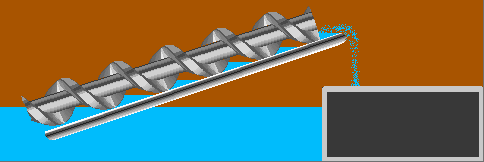
![[Unknown machine or pump]](powder26-s.jpg)
Some sort of machine. It was a long (20 foot or so) device about 18" in diameter, with some sort of shaft in the middle (which has fallen to the bottom of the device in this picture). I believe it is some sort of pump (Archimedes Screw type).
![[Anchors in side tunnel]](powder27-s.jpg)
More of those anchors in the side tunnel.
![[Another anchor]](powder28-s.jpg)
Yet another anchor.
![[Rubble in side tunnel]](powder29-s.jpg)
A pile of rubble in another side tunnel. I could not determine if this was the result of an abandoned tunnel, damage from an explosion, or placed in the tunnel intentionally to block it.
![[Mountain face and steelwork]](powder30-s.jpg)
Having made it back out of the tunnel, this is a view of the mountain face meeting the outside of the entrance, on the right side of the shaft.
![[Left side of plug]](powder31-s.jpg)
The left side of the shaft entrance. The hole we used is out of the frame on the bottom.
![[Another brick building]](powder32-s.jpg)
Another damaged brick building.
![[Looking across the river]](powder33-s.jpg)
Things get interesting again. This is a view across the river, where there is another walled-off tunnel very similar to the one we just saw. But this one is in a much better state of repair and has power lines going into it. On a subsquent visit this tunnel had been re-opened and there was a gate across it and guards. This tunnel is on the [then] DuPont property on the east side of the lake.
DuPont maintained an explosive manufacturing facility for various high-tech explosives on that side of the river. A page (no longer available) on DuPont's web site states that the "Explosive specialties - Pompton Lakes, NJ." division was divested or shut down in 1994.
Local rumor is that the DuPont site was involved in "explosive welding" technology, and that this technology was used to make the metallic laminates in US coins like the dime and quarter.
On a later trip, I observed the DuPont site from public roads. There was a large lawn-like area with white boxes perhaps 2 feet cubed scattered around, some on stilts and some on the ground. It looked sort of like commercial beehives. I am told that these boxes were used to test the weathering properties of assorted high explosives. Rich told me that this is where he got the explosive to open the shaft.
![[Aother building]](powder34-s.jpg)
Another remnant of a building. This one is worn (or blasted) down almost to ground level.
![[Railroad bridge]](powder35-s.jpg)
The remnants of a railroad bridge across the Wanaque River near the north end of Lake Inez. While it is not apparent from this picture, the ground at the left side of the picture is about 15 feet lower than the height of the bridge. I assume this is displaced earth from the explosion. The railroad line in question is an industrial branch line of the Erie Lackawanna, and the tracks can be seen crossing Ringwood Ave just north of Doty Road.
![[MapQuest map]](mapquest.gif)
![[Wide aerial view]](aerial-wide.jpg)
![[Closeup aerial view]](aerial-closeup.jpg)
![[Old stone wall]](powder04.jpg)
![[Another view]](powder05.jpg)
![[Marks on wall]](powder06.jpg)
![[Z-shaped building]](powder07.jpg)
![[Brick building]](powder08.jpg)
![[Unusual foundation]](powder09.jpg)
![[Plug side view]](powder10.jpg)
![[Plug end view]](powder11.jpg)
![[Flashlight and hole]](powder12.jpg)
![[Looking southeast]](powder13.jpg)
![[Looking south]](powder14.jpg)
![[Lake Inez and shed]](powder15.jpg)
![[Metal anchor #1]](powder16.jpg)
![[Metal anchor #2]](powder17.jpg)
![[Cylindrical object]](powder18.jpg)
![[Cylindrical object]](powder19.jpg)
![[Dam at end of tunnel]](powder20.jpg)
![[Dam at end of tunnel]](powder21.jpg)
![[Looking toward entrance]](powder22.jpg)
![[Looking toward entrance]](powder23.jpg)
![[Inside wall near entrance]](powder24.jpg)
![[Looking down side tunnel]](powder25.jpg)
![[Unknown machine or pump]](powder26.jpg)
![[Anchors in side tunnel]](powder27.jpg)
![[Another anchor]](powder28.jpg)
![[Rubble in side tunnel]](powder29.jpg)
![[Mountain face and steelwork]](powder30.jpg)
![[Left side of plug]](powder31.jpg)
![[Another brick building]](powder32.jpg)
![[Looking across the river]](powder33.jpg)
![[Aother building]](powder34.jpg)
![[Railroad bridge]](powder35.jpg)